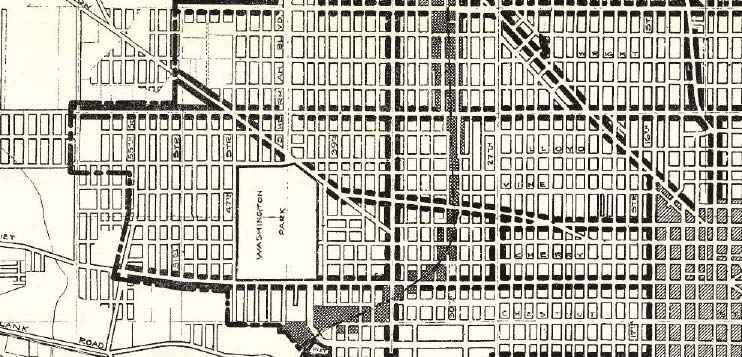
Washington Park's Boundaries
Assessment of Boundaries in a Dynamic Neighborhood
Like many other urban neighborhoods in the 1920s, Washington Park saw a post-war boom that raised the population and industrialized the area. Evidence of industrial push-and-pull can be found in the way the City of Milwaukee determined ward and district borders in the neighborhood, but the motives behind district and ward lines can only be speculated.
In the early 1920s, industry was primarily centralized within densely populated areas, which, in turn, attracted a greater population. This environment also saw little regulation. In comparison to many East Side areas, zoning information has not been readily available or present in archives. This may reflect the city's attitude about its most western border. Subsequently, these maps show how lines around the park are drawn without apparent justification or regulation. At the close of the 1920s and the open of the 1930s, much of the industry shifted from the central city to outlying neighborhoods like Washington Park, as stated in Jim Nelsen's Milwaukee School Desegregation in the 1960s. During this time, a "tightening up" of the district and ward borders can be seen. Jim Nelsen points to policy of segregation that was rampant during this time; however, this practice was called out in later years as harmful to the value of the neighborhood. A 1956 Milwaukee Journal article attributes this rash and "ill-informed" reassessment policy to the devaluing of homes in the area. |
Learning Topics
|